Open Geodata Training Curriculum
Data for Good at Meta has partnered with the Open Knowledge Foundation to design, develop, and deliver a training focused on how governments and nonprofits around the world can utilise free and open geospatial data and geospatial software. This website contains a training curriculum built around the powerful free and open source GIS, QGIS, for learning how to utilize free and open geospatial data such as OpenStreetMap (OSM) and Meta's High Resolution Settlement Layer (HRSL). The curriculum is localized for 16 countries and available in 7 languages (Amharic, Arabic, English, German, Portuguese, Spanish, and Vietnamese). You can select the language and country localization below.
You can also find sample projects made by those trained using the curriculum in the Showcase Page.
Select Language
Select the language of the homepage
Select curriculum localization
Select the curriculum you want to view
Tutorials
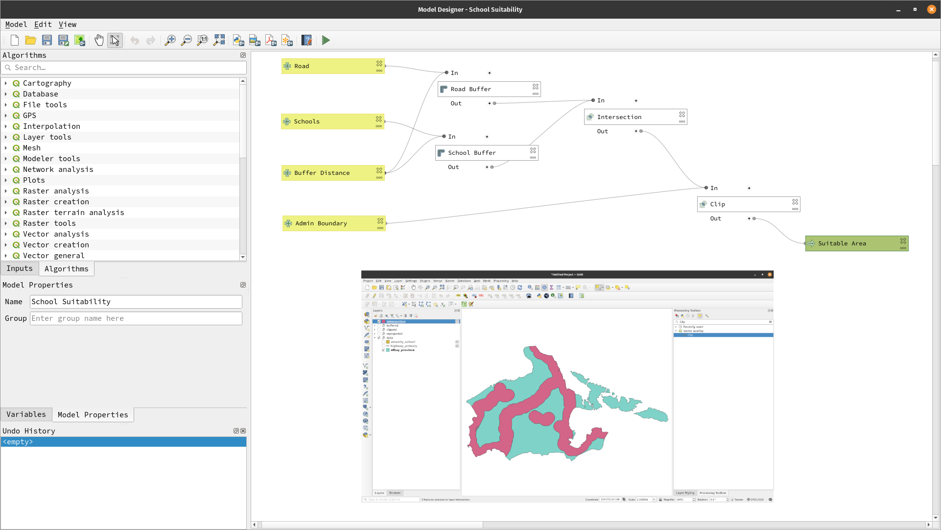
Site-suitability analysis and the graphical modeler
en
Network analysis in QGIS
en
Case Studies
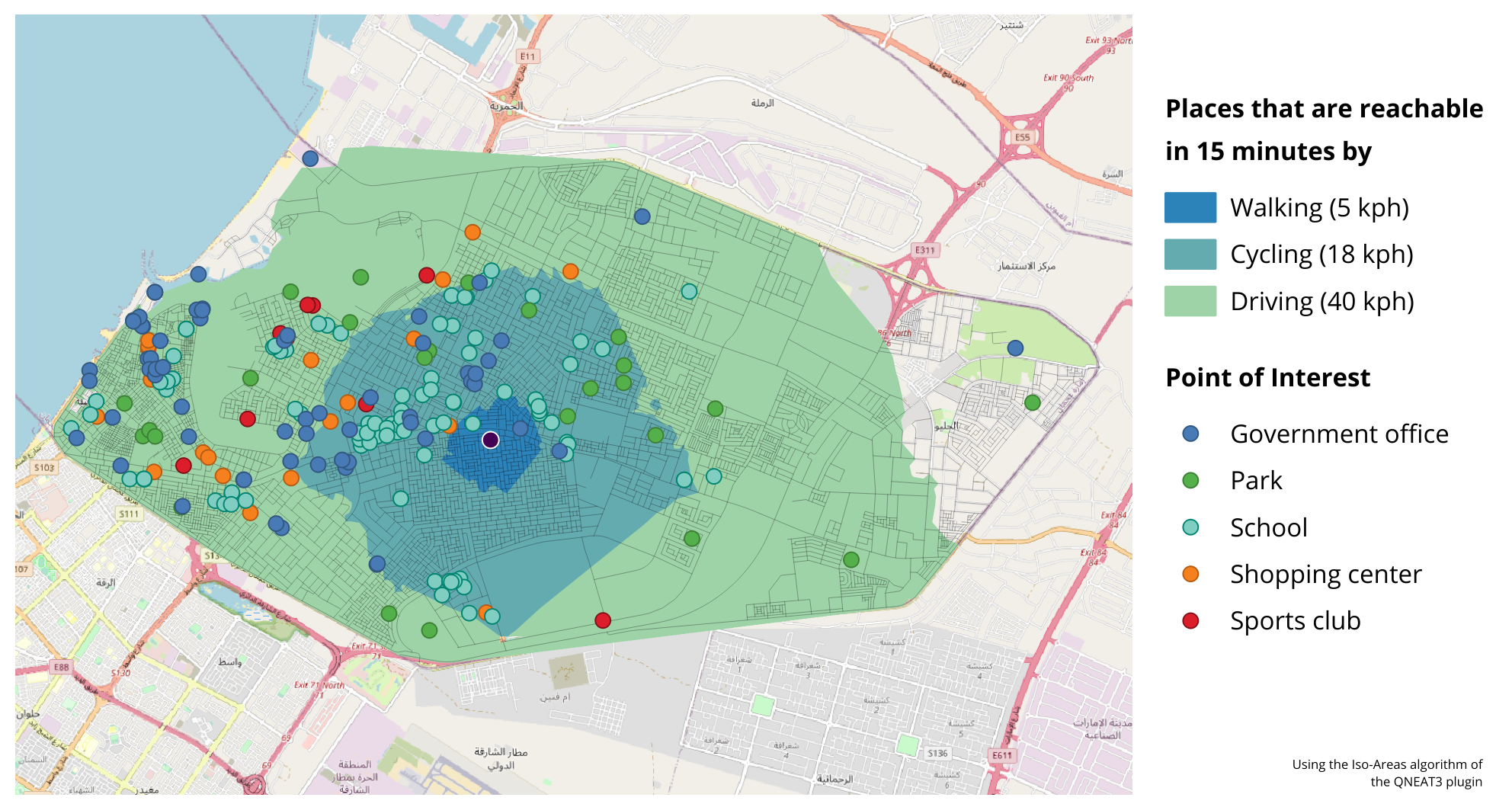
Designing a 15-minute city with QGIS and high resolution population data
United Arab Emirates, en

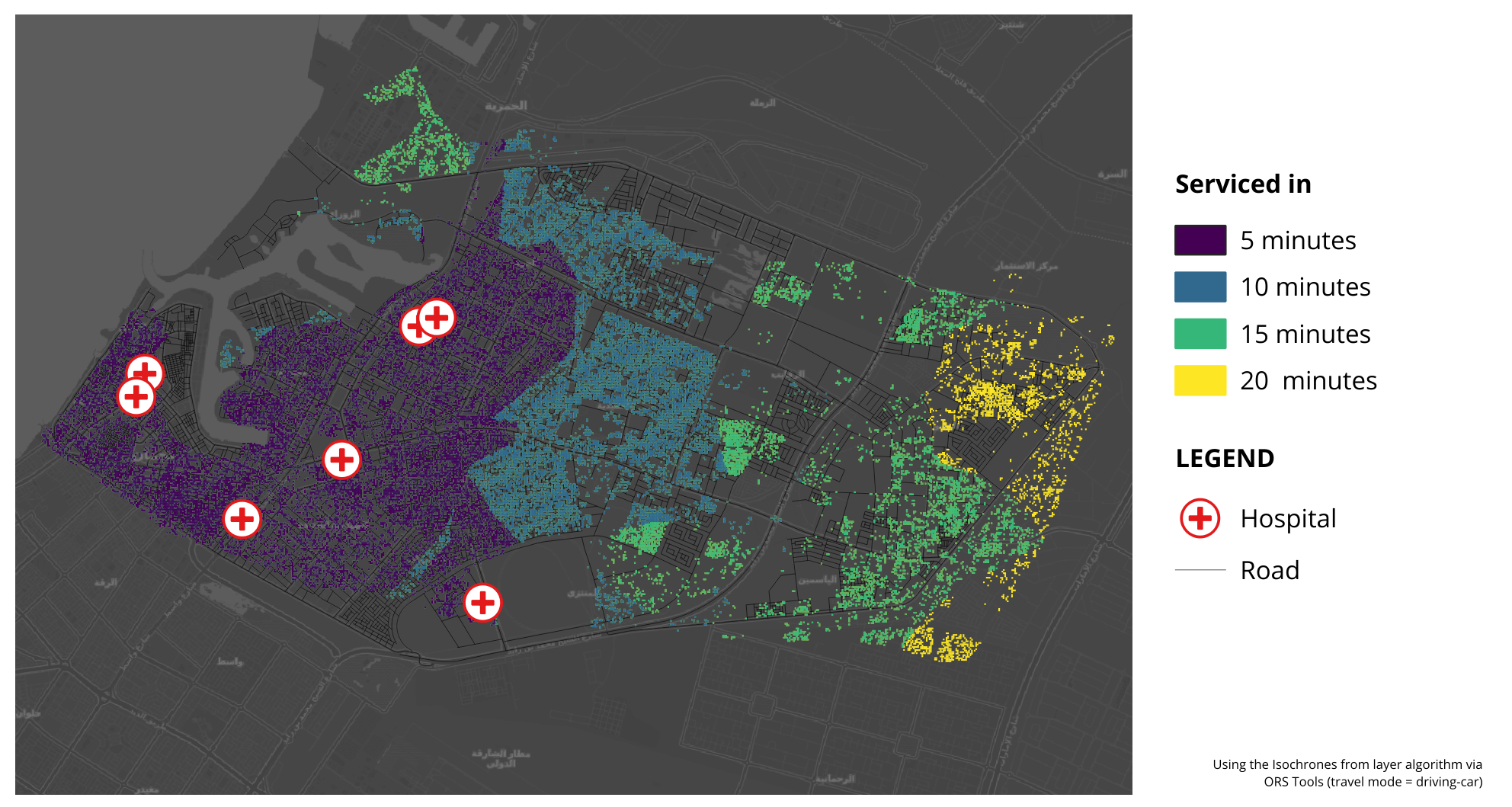
Mapping flood exposure in the Philippines
Philippines, en
Project Showcase
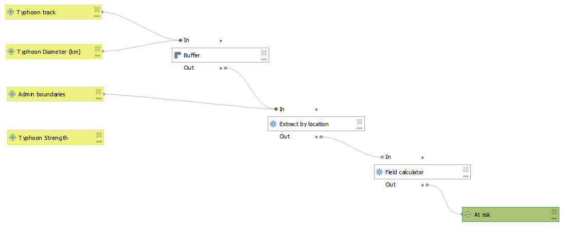
Tropical Cyclone Risk Assessment Model
Philippines, en
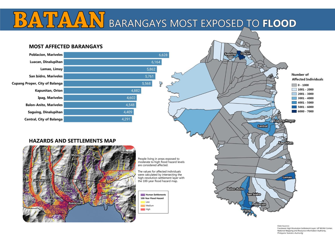
Bataan Barangays Most Exposed to Flood
Philippines, en
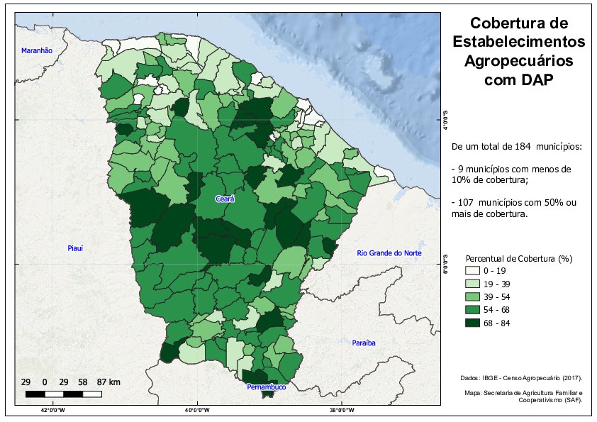
Family farming
Brazil, en
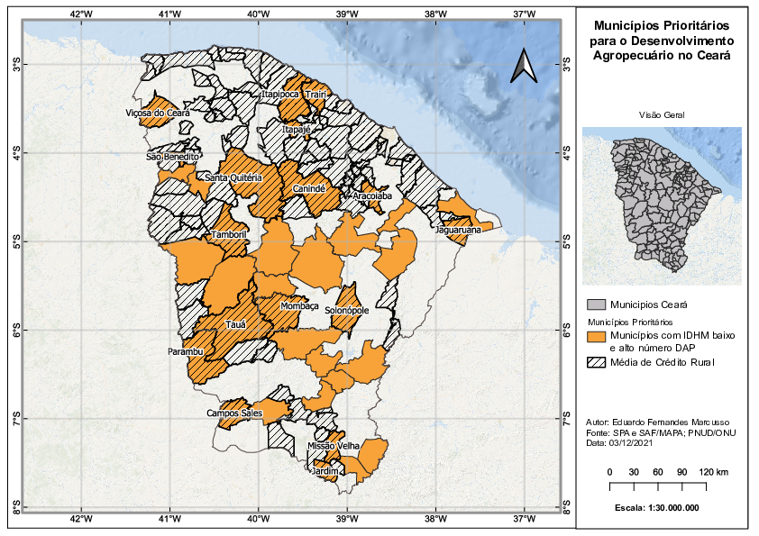
Rural Credit
Brazil, en
Source code available under the MIT license.
Content on this site, made by Open Knowledge Foundation, is licensed under a Creative Commons Attribution 4.0 International License.
Refer to our attribution page for attributions of other work on the site.